An Old Favorite Drive Revisited
|
For whatever reason, back in the good old days, I learned of a wonderful way to waste a couple of hours. It's turned into my favorite drive through the country. Imagine my delight when a new cache showed up just at about the half-way point! |
 |
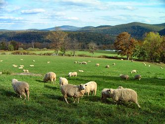 |
Head on up 29 and hang a left on Sugar Hollow Road to Mehoopany - one of the most beautiful roads in Wyoming County, along which you will find more sheep than Noxen ever dreamed of! (No snide remarks, please.) |
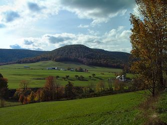
Turn left at Mehoop and again a few
miles later at Forkston, and enter a land where the hills pop up
out of the landscape like bubbles... |
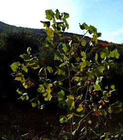 And the trees borrow light from the sun. |
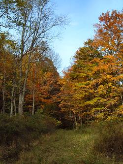 |
Out here they do fireworks like you have never seen before, that echo off the mountains for so long you think it will never stop. Out here the leaves turn a special pallette of Autumn. Out here the hunters will soon roam. But now, out here, there is peace and fresh air and beauty. Just as you start to go up into the hills, there's a little trail I never really noticed before, and on a high knob above it, is a geocache, which I found with little difficulty. I never dreamed, driving around here in the 60's, that I'd be driving around here in the 00's, with a whole new technology bringing me back to these hills. |
| An ordinary cache, as caches go, but with a cool little bear. This is no ordinary bear, however - he is wearing a travel bug, which means I am to take him and place him in another cache. In this way, he will travel to some of America's most beautiful places! You can track his progress using the number on that "dog tag" he's wearing around his neck. | 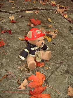 Here he is taking a last look around his most recent domain. Click here to see where he's been. (He's just getting started!) |
 |
|
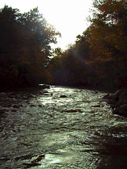
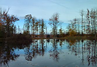
Before you head on up into the
hills, take a moment to marvel at Mehoopany Creek. It works it's
way down from North Mountain to the Susquehanna. Looking upstream
into the sun, it's almost monochromatic; to see the colors, you
have to let the sun help you.
|
 Time to move on... |
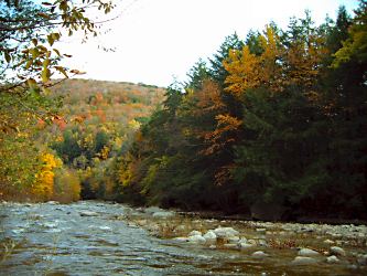 |
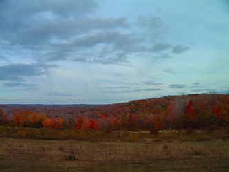
| When you finally get to the top, you will drive along for miles, hovering between 2,000 and 2,200 feet, along with the turkey buzzards. Up here there are wonnderful sights to see. A few miles off the road at the summit is an obandoned coal mine you can walk right into, (though I don't recommend it) and there are painted meadows and hills. | 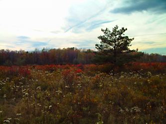 |
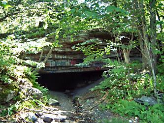 |
It's hard to imagine that they haven't sealed this thing off - talk about an attactive nuisance! You can stand right up in there, although it's not obvious from this picture, but wowzers - it gets dark in a hurry! |
|
I much prefer the hills and lakes
and the deer....
|
 |
 |
| I think there are more deer than people up here... | 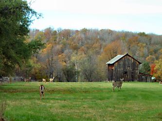 |
|
...which is reason enough to visit. But the light is starting to get a little golden, which means it's time to get going. |
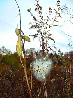 |
Right after I get a
few shots of these milkweeds doing their best to propogate their
specie. |
With thanks to Johnsons06 for a great excuse to visit a favorite part of the country.
Visit the cache page at www.geocaching.com, where you will learn that I was only one of three finders today, though I ran into no one!
© Frank Burnside Jr. 2003